Heritage Reconstruction: How to Reduce Costly Errors Using 3D & BIM. Part 1
August 20, 2024 at 7:00 am,
No comments
Reconstructing heritage or historic buildings is often notoriously challenging due to the many unknowns that can lead to significant design changes during construction and increased costs. However, modern technological advances—such as Building Information Modeling (BIM), LiDAR 3D surveying, and other —have evolved significantly, enabling the reduction of these unknowns with a relatively modest initial investment.
In this two-part article, I explore some of these innovative tools and processes to help you minimize unexpected surprises during the reconstruction of heritage buildings.
Common Issues in 2D Design of Heritage Buildings
While many issues encountered during the 2D design process for heritage buildings are similar to those in new construction—such as errors and missing information in blueprints—there is a critical initial step for heritage projects: capturing the existing site data in as much detail as possible.
Standard methods, like taking photos, using laser measures, and uncovering limited areas of structures to gather information on element placement, are still widely used around the world for many heritage buildings. While these methods may suffice in simple cases, my personal experience shows that they often lead to significant errors, such as incorrect measurements and missing information, which in turn result in faulty designs.
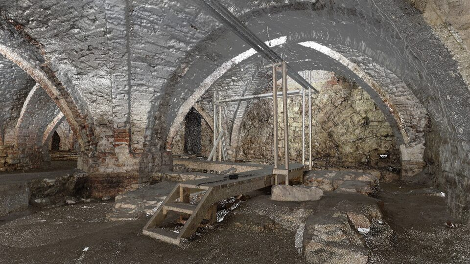
Image: 3D survey of a basement
How 3D & BIM Improves the Quality of Design
In simple terms, Building Information Modeling (BIM) for heritage buildings involves recreating the existing structure as accurately as possible in a digital environment. This digital representation is then used to develop better design solutions, leading to fewer surprises during construction and a final result that closely aligns with the owner’s or client's initial expectations.
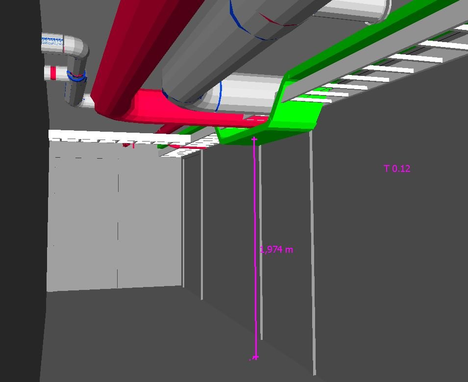
Image: design error ir heritage building. Trying to fit in modern MEP networks can be a challange.
Advanced surveying methods, such as LiDAR and photogrammetry, can greatly enhance this process, and I will explain why shortly. Once the initial data capture and modeling of the building are completed, many of BIM’s other benefits can be leveraged, such as automated drawing generation and constructability analysis.
Capturing Initial Data
Accurate initial data is crucial for any design process, whether for new construction or heritage building reconstruction. While new construction primarily focuses on land plot data, reconstruction must account for the existing structure.
The process of capturing initial data can be divided into two categories:
- Non-destructive methods: These involve examining and documenting a building without causing damage, making them ideal for historic preservation.
- Destructive methods: These involve physically altering or removing parts of the structure to gather information, often used when non-destructive methods are insufficient or inconclusive.
Both groups use various information-gathering techniques, such as visual inspection, sample testing, and probing. However, for the successful development of Building Information Models (BIM), non-destructive methods like photogrammetry and LiDAR are fundamental.
Photogrammetry creates accurate 2D and 3D models by analyzing multiple overlapping photographs taken from different angles. Drones are often used to capture these images, ensuring significant overlap. Specialized software then processes the images to reconstruct the object's geometry into a point cloud or 3D model. Additional outputs include orthophotos and 360-degree photos.
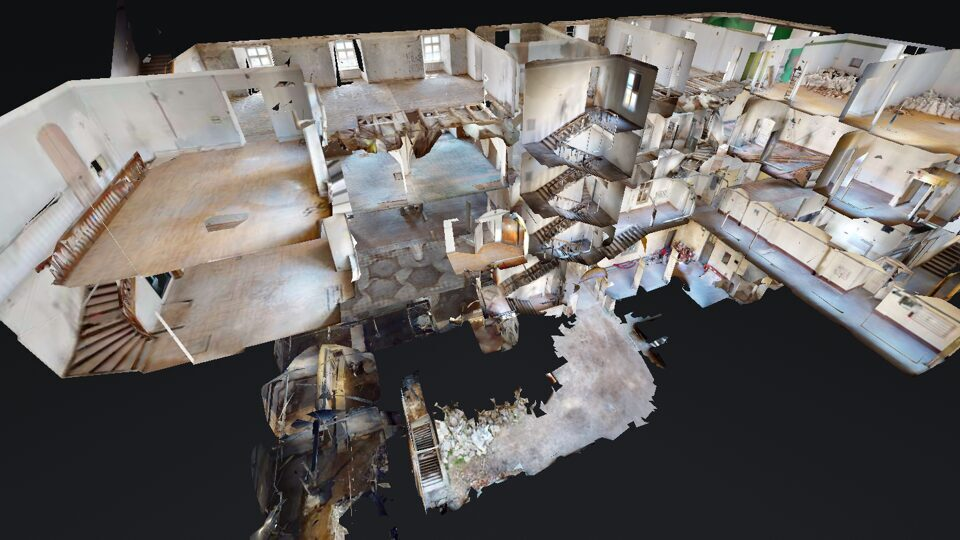
Image: photogrammetric model of a building
Laser scanning (LiDAR) employs laser scanner devices that emit laser pulses, which bounce back to record precise distances. This data is used to create a point cloud representing the building’s surface. Multiple scans are combined to produce a comprehensive 3D model.
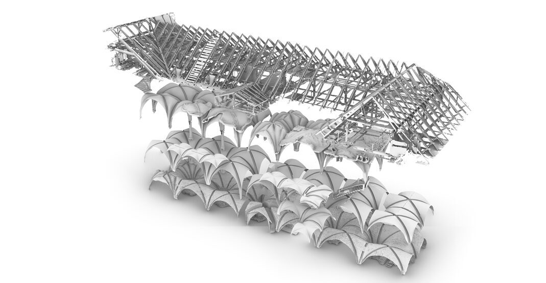
Image: mesh 3D model of complex building structures
Both technologies can achieve high levels of accuracy, even within millimeter precision. However, a major limitation is that the data captured reflects only what is visible, meaning objects hidden behind structures are not surveyed. One way to address this is by conducting a second survey after demolition work is done and comparing the captured data with the designed BIMs to determine if any design adjustments are necessary.
I highly recommend using 3D surveying for reconstruction projects of any size, as other methods are typically far less accurate and can provide designers with misleading information, leading to significant rework during construction. Also the costs for having these surveys done have dropped significantly over the past years, allowing to utilize them even in projects with very limited budged. While photogrammetry and LiDAR are invaluable for capturing existing conditions, traditional methods are still necessary for processes like structural evaluation and other specific assessments.
In the second part of this article, I will discuss how this data is used to create Building Information Models (BIM), how these models are typically applied, and the tools clients can use to stay involved and make more informed decisions.